Posts

Showing posts with the label glottolog

Linguistic map making: Drawing polygons

Image
Hedvig has written o n how Ethnologue has become even more restricted than it already was , and what resources are out there that could be used instead. One of the things I miss from Ethnologue are its maps - although at least recently it was still possible to access most of these, by downloading them instead of viewing them on your browser. In her post, Hedvig points out that Langscape can be used instead, and that's all great. But what if you wanted to draw a map yourself? Especially one which you intend to publish? Some institutions may have access to the World Language Mapping System  (WLMS), which lies at the core of Ethnologue's (and Langscape's) maps, and was made by Global Mapping International ( which recently was closed, and now the WLMS is back formally with SIL ). I'm not sure about the details (and the user agreement parts of the WLMS website are down), but paying a lot of money for the WLMS must enable users to draw their own maps and publish them, as ...
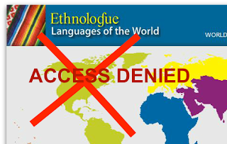
Ethnologue more restricted

Image
In April this year, Ethnologue changed access restrictions to their website again. Now, non-paying users from high income countries can only access 1 page per month before they are banned, previously it was 7. In light of this change, we will go through some basics regarding the paywall again (old post here) and where you can go instead. Finally, I list some questions should any SIL International/Ethnologue staff see this post. Basics on the pay-wall We haven't received much detailed information on this change, but if it's the same as last time it means that users with IP-addresses in countries that are classified by the world bank as "high-income" will be restricted.   Cloudflare would appear to be the service provider managing this for Ethnologue.  Previously, we've learned that only 5% of users look at more than 7 pages per month.  We don't know how many go to more than 1 page (probably a lot more though!). SIL International also maintains the IS...

Speakers per language diagram & International Linguistics Olympiad memes

Image
Hello readers of Humans Who Read Grammars, As well as writing on this blog, I also work with the International Linguistics Olympiad (IOL*). The IOL is a contest for students of secondary school from all over the world where they get to compete in solving linguistic puzzles. Normally in order to explain what the contest is all about I send people to the page with old problem sets,  but there's a hip IOL-meme page that's produced some very apt memes that may do a better job at explaining the contest to linguists. I'll paste them in below. ( Remember how we started as a meme-based blog for typologists? ) I recently made a post on our blog over there about the dominance of European countries in the contest and language diversity . For that post, I derived a little data visualisation of speaker populations per language (based on the 19th edition of Ethnologue) with infogram . I thought y'all might like it as well, so I'm sharing it here too. By the way, if you...

New Approaches to Ethno-Linguistic Maps

Image
I’m excited to give a guest blog post here at humans who read grammars on new methods in language geography.  I’m a geographer by trade, and I am currently a PhD student at the University of Maryland.  I also work for an environmental nonprofit - Conservation International - doing data science on agriculture and environmental change in East Africa.  Before ending up where I am now, I lived for some time in West Africa and the Philippines.  During my time in both of those linguistically-rich areas, I became quite interested in language geographies and linguistics more generally.  Spurned on by curiosity and my disappointment in available resources, I’ve done some side projects mapping languages and language groups, which I’ll talk about here. Problems with Current Language Maps A map of tonal languages from WALS.  Fascinating at a global scale, but unsatisfying if you zoom in to smaller regions. One major issue with most modern maps of languages is...

World map of language families from Glottolog

Image
World map from Glottolog, each language is one dot and coloured by language family (or other top-genetic unit). Language families are the main way we categorise and understand the language diversity of the world. A language family is a group of languages that have been analysed as having one ancestor,  one great-great-great-and-yet-greater-grand-mother language. Indo-European is a language family, with the sub-groups of Romance, Germanic, Slavic etc. Maps are great tools for visualising information,  we're pretty map-nerdy on this blog.   Robert Forkel, one of the editors of Glottolog, kindly shared an interactive map of the world with languages plotted out and coloured by language family with me. This map is interactive, rendered in a web browser with and html and json file. This map is not available on the Glottolog site, but will later be implemented in the command-line interface.  You can see language families on the website by either selecting a co...